Mining
Monday, July 15th, 2024 4:17 pm EDT
Key Points
- Completion of Exploration Program: Greenridge Exploration Inc. has completed its 2024 exploration program at the Weyman project in southeastern British Columbia, which included a total metal ion survey and detailed geological mapping. The soil samples collected are being analyzed, and the results are expected in the coming weeks.
- Key Geological Findings: The exploration revealed a significant hydrothermal system and alteration zone adjacent to the Weyman thrust fault, with potassic and propylitic alterations indicating potential for porphyry copper-molybdenum-silver-gold deposits. This zone, characterized by resistant, silicified rocks, offers substantial outcrop exposure for further mapping.
- Project Overview and Future Prospects: The Weyman project is part of Greenridge’s broader strategy to explore and develop critical mineral projects in North America. The detailed mapping and upcoming soil survey results will enhance technical knowledge and guide future exploration efforts, particularly in areas north and east of the newly mapped alteration zone.
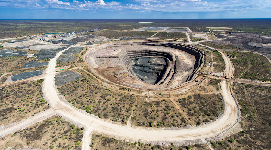
Greenridge Exploration Inc. has completed its 2024 exploration program for its Weyman project located in southeastern British Columbia. The project covers approximately 6,925 acres of land and comprises seven map-staked mineral claims in the southern Quesnel terrane of British Columbia.
The program included conducting a total metal ion survey and 1:5,000-scale geological mapping on the property (please see news release dated May 7, 2024). All of the soil samples have been successfully dried and sent to the lab for analysis. The results of the current soil survey will become available once the lab analysis of the soil samples has been completed and its anticipated results will be available in the coming weeks.
Russell Starr, chief executive officer of the company, commented: “Detailed mapping of the Weyman project, along with results of the soil survey, will significantly increase our technical knowledge of the project. We look forward to reviewing those results of the soil survey to guide future exploration programs.”
The focus of the program was on the western part of the property area where a high-angle thrust fault (the Weyman thrust) was accompanied by an intense aeromagnetic low and a group of 2021-era soil copper anomalies.
Current geological mapping revealed that a hydrothermal system is exposed adjacent with the western side of the aeromagnetic low. The hydrothermal system is exposed on surface for more than two square kilometres (1.22 square miles). It has produced an alteration zone that is exposed at the top of a cupola of the Wild Horse batholith. In the interior of the alteration zone, potassic and both prograde and retrograde propylitic alteration are substantial. Alteration intensity is less intense toward the margins of the alteration zone as should be expected. Such alteration is typical of that enveloping mineralization of porphyry copper-molybdenum-silver-gold deposits throughout the Quesnel and Stikine terranes in British Columbia. The central part of the alteration zone is surrounded by a ring of several local soil-copper anomalies from the 2021 soil survey.
Rocks in the alteration zone are Nicola-belt, fine-grained, water-lain andesite and basalt that have been intruded by the Wild Horse batholith which is granodioritic to dioritic in composition. The contaminated upper contact of the intrusion is exposed at surface throughout the alteration zone. Silicification has hardened the local rocks and rendered them resistant to weather and grinding by glacial ice. Consequently, rock outcrop is substantial in that area making it relatively easy to map the alteration zone.
The current soil survey was conducted in areas flanking the newly mapped alteration zone, mostly to its north and east, where there is very little rock outcrop.
National Instrument 43-101 disclosure
John Ostler, MSc, PGeo (EGBC licence No. 18415) is an independent qualified person as defined by National Instrument 43-101 — Standards of Disclosure for Mineral Projects. Mr. Ostler has reviewed and approved the technical content in this release.
About Greenridge Exploration Inc.
Greenridge Exploration is a mineral exploration company dedicated to creating shareholder value through the acquisition, exploration and development of critical mineral projects in North America. The Carpenter Lake uranium project is located in the Athabasca basin consisting of seven mineral claims covering 13,387 hectares across the Cable Bay shear zone and the company is advancing the project to test multiple high-priority targets. The company’s Nut Lake uranium project located in the Thelon basin includes historical drilling which intersected up to nine feet of 0.69 per cent triuranium octoxide including 4.90 per cent U3O8 over one foot from an eight-foot depth.
The company’s Weyman copper project in southeast British Columbia sits on the south portion of the famous Quesnel terrance. The company is led by an experienced management team and board of directors with significant expertise in capital raising and advancing mining projects. The Snook and Ranger Lake uranium projects, 4,899 hectares and 20,782 hectares respectively, are located in Western Ontario, with multiple previous uranium occurrences across both projects.
We seek Safe Harbor.